
فائل:ET Bahir Dar asv2018-02 img32 view from Bezawit.jpg

ایں پیشگی ݙکھالے دا حجم:٨٠٠ × ٥٣٣ پکسلز ٻیاں قرارداداں: ٣٢٠ × ٢١٣ پکسلز | ٦٤٠ × ٤٢٧ پکسلز | ١,٠٢٤ × ٦٨٣ پکسلز | ١,٢٨٠ × ٨٥٣ پکسلز | ٢,٥٦٠ × ١,٧٠٧ پکسلز | ٧,٦٨٩ × ٥,١٢٦ پکسلز۔
اصل فائل (٧,٦٨٩ × ٥,١٢٦ پکسل، فائل دا حجم: ١٠.٩٨ MB، MIME قسم: image/jpeg)
خلاصہ
| تفصیل |
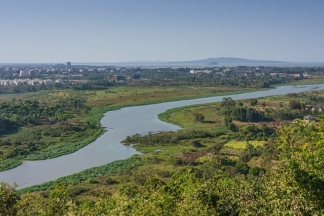
English: View from Bezawit Road – Blue Nile River in Bahir Dar, Ethiopia
Русский: Вид с холма на Голубой Нил в Бахр-Даре, Эфиопия |
| تریخ | |
| ماخذ | اپݨا کام |
| مصنف | A.Savin |
| اجازت (فائل دا دوبارہ استعمال) |
.svg) Just attribute the author: «A.Savin, Wikipedia»; if you have questions — Telegram, or e-mail to wikiphotospace@gmail.com..svg) Просто укажите в качестве автора: «А.Савин, Википедия»; если есть вопрос — телеграм, или эл.почта на wikiphotospace@gmail.com. Kennzeichnen Sie einfach als Autor: «A.Savin, Wikipedia»; falls Sie Fragen haben — Telegram, oder E-Mail an wikiphotospace@gmail.com.
Thank you. |
| Camera location | | View this and other nearby images on: OpenStreetMap |
|---|
اجازہ کاری
| Copyleft: This work of art is free; you can redistribute it and/or modify it according to terms of the Free Art License. You will find a specimen of this license on the Copyleft Attitude site as well as on other sites. |
فائل دا تاریخچہ
کہیں خاص ویلے تے تریخ کوں فائل کین٘ویں نظردی ہائی، ݙیکھݨ کیتے اوں ویلے تے کلک کرو۔
| تریخ/ویلہ | تھمب نیل | پاسے | ورتݨ والا | رائے | |
|---|---|---|---|---|---|
| موجودہ | ٠٥:٤٣, ٣٠ جون ٢٠١٨ | | ٧,٦٨٩ × ٥,١٢٦ (١٠.٩٨ MB) | A.Savin | {{User:A.Savin/F |Description= {{en|View from Bezawit Road – Blue Nile River in Bahir Dar, Ethiopia}} {{ru|Вид с холма на Голубой Нил в Бахр-Даре, Эфиопия}} |Year=2018 |Country=Ethiopia |Month=02 |Day=05}} {{Location|11|34|31.3|N|37|24|45.6|E|region:ET-AM}} Category:Taken with Sony ILCE-7RM3 Category:Taken with Sony FE 24-105mm F4 G OSS Category:2018 in Ethiopia Category:Blue Nile in Bahir Dar |
فائل ورتݨ
اِیں فائل نال ہیٹھاں درج ورقہ مربوط ہے:
فائل دا کلجگ ورتاوا
ایہ ٻئے وکی ایں فائل کوں ورتیندن:
- ar.wikipedia.org تے ورتݨ
- ban.wikipedia.org تے ورتݨ
- bh.wikipedia.org تے ورتݨ
- bn.wikipedia.org تے ورتݨ
- bs.wikipedia.org تے ورتݨ
- ca.wikipedia.org تے ورتݨ
- cv.wikipedia.org تے ورتݨ
- en.wikipedia.org تے ورتݨ
- eo.wikipedia.org تے ورتݨ
- et.wikipedia.org تے ورتݨ
- fy.wikipedia.org تے ورتݨ
- incubator.wikimedia.org تے ورتݨ
- is.wikipedia.org تے ورتݨ
- it.wikipedia.org تے ورتݨ
- kn.wikipedia.org تے ورتݨ
- mk.wikipedia.org تے ورتݨ
- sh.wikipedia.org تے ورتݨ
- sk.wikipedia.org تے ورتݨ
- sw.wikipedia.org تے ورتݨ
- tr.wikipedia.org تے ورتݨ
- uk.wikipedia.org تے ورتݨ
- ur.wikipedia.org تے ورتݨ
- xmf.wikipedia.org تے ورتݨ